Travel:Iglesias>Antas>Buggerru> Scivu>Piscinas Dunes. Sardinia. Oct. 4th/2024
- Lili Naveh
- Oct 4, 2024
- 7 min read
Updated: Nov 6, 2024
A continuation of a trip which started on Sept 10th with visit to the UK, then Corsica
Corsica to Sardinia 9/29 (here)
Pula 9/30 - 10/3. (here)
On the day we departed t Pula , its coastal beautiful Southern surrounding, and the great small hotel we stayed at in Pula- Sant Efis Hotel , the clear sunny weather, turned cloudy and rainy., during the 1.5 hours drive up toward Temple Antes archeological site.

The scenery of Sardinia's flat interior which unfolded initially during the drive,
toward the island's Southwest, is not at all remarkable, and reveals industrial or farm land with some salt pools mining
Once the climb through the interior mountainous landscape started ,also the scenery
become more attractive. and verdant
On the way to the Temple Antas archeological site, the following was passed through:
Iglesias -Once famous for its Mining History

In the hills of Southwestern Sardinia, the town of about 30,000 inhabitants lies less then an hour, west-northwest of Cagliari, and has become the most important town in the region.


Famous for its historic Punic and Roman past, and linked to the mining activity, to medieval folklore and many churches site, as the town's name Iglesias, reveals its cathedral Saint Clair of Assisi, the patron saint of the city, dates from 1288,
The town was known in the past as Villa Ecclesiae. The Aragonese who, after conquering it in 1324, named it Iglesias and made it an important city of their Sardinian domain. Under Spanish control Iglesias was one of the most important royal cities on Sardinia, and it is the seat of the Roman Catholic Diocese of Iglesias.

The town's importance was already established, by the Romans as it was close to the various mining centers in the region, in which lead, zinc, and silver are mined and sulfuric acid is distilled.
When the city passed with the rest of Sardinia to the House of Savoy. since the mid-19th c, and thanks to the reopening of nearby mines, Iglesias has experienced a period of economic, social and cultural renewal and many miners, workers and technicians from elsewhere on Sardinia and northern Italy settled in the city,

However After the II World War the Sardinian mining sector was in crisis, which effected the town after many nines closed. The local mining school houses a museum of mineralogy opened in 1871
The drive from Inglesias through Fluminimaggiore , the area were Temple Antas is nested, passes through a mountainous enchanting woodland vegetation of a very verdant dense Marganai forest, covered by holm oaks pines, wild olive and strawberry tree, shrubs, crawling ferns and .....grazing herd

Grazing in the mountainous Forest


The rural community stretching from the mountains to the sea, along the valley of the Rio Mannu river. in the Province of South Sardinia, is of about 3000 inhabitants. and 60km northwest of Cagliari .


The river flows through and powers the blades of the Zurru Licheri mill which dates back to 1750 and is currently an ethnographic museum about the local culture and history.
The closed Furmaggeria in the midst of the village
There are many intriguing colorful Wall Paintings on the village's buildings

In the midst of the forested landscape are folded the historic mining period and 2 of the most important natural and archaeological attractions on the island.

The current municipality was established in 1704 when Viscount Asquer authorized the rebuilding of the village of Flumini Major, which had been uninhabited for a century.
The agricultural village, was converted, from the end of the 19th c into a support center for mining activities, There are about 30 abandoned mining sites in the territory.
The ghost village of the Malacalzetta mine stands out,
The abundant mine of su Zurfuru SS126, Fluminimaggiore +39 340 00 01 995;


Temple of Antas

The impressive Temple is one of the greatest monuments of Sardinian antiquity,
situated, in an area colonized by the Carthaginians and then by the Romans, who were attracted there, by the silver and lead deposits in the area.

Hidden in the valley of the River Antas, the Temple of Antas is located 9km south of Fluminimaggiore village, in a lush valley of Fluminimaggiore countryside, dominated by Mount Conca s'Omu.
The Temple was built from local limestone and is characterized by a flight of steps with three levels (originally more) and a podium decorated with elegant columns delimiting the votive areas.
Erected originally as a Nuragic sanctuary (9th BC), to the local Sardinian deity -
god Sardus Pater Babai, the main male divinity of the Nuragic civilization , later worshiped by the the Carthaginian, who incarnated it into god Sid Addir - god of warriors and hunters, it continued living through the Punic-Hellenistic phases.
During the Roman era, the temple reached its maximum splendor.
The Roman temple was re-built by emperor Augustus (27 BC - 14 AD) and restored by Caracalla (213-217 AD).
A nearby tomb excavated the bronze statue of a deity: perhaps the Sardus Pater or the Punic god Sid, a transposition of the local deity Babai.
After lying abandoned since the 3rd AD for centuries, the temple remains were discovered in 1836 by general Alberto La Marmora, and restored to the current state
in 1967 . Most impressively, the original Ionic columns were excavated and re-erected.
The archaeological site of the temple, also includes a small necropolis, remains of an ancient Nuragic village (13th-10th BC), Roman quarries of limestone and an ancient path connecting the temple to a sacred cave where the water cult was practiced.
The buildings in the historic center are built of stone and raw earth.

Leaving the Temple and serpentine mountainous countryside, behind, the drive along the beautiful coastal shore, doted with various coves and caves, was a remarkable change in the scenery.

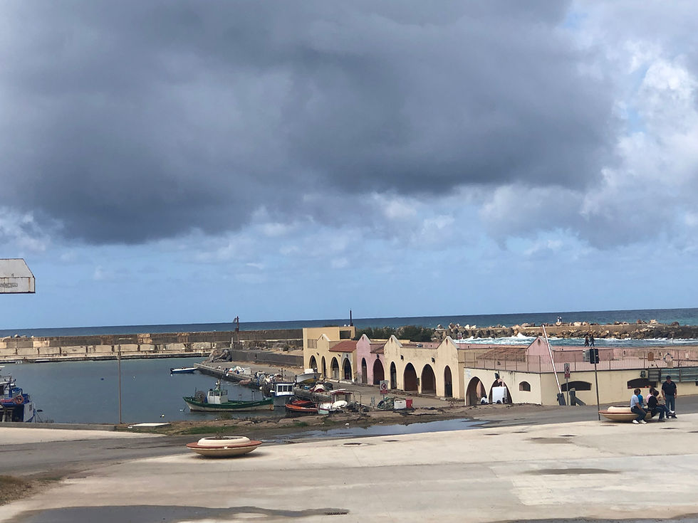
Buggerru - A Sea Side Village


This past mining village, (from 1864) which lies hidden deep between a mountainous area and a beach, is now a tourist hub, known for shallow water and a sandy seabed,
It is located about 70 km northwest of Cagliari on the Southwestern coast

Buggerru, which was already known for its silver by the Romans, produced also more than a million tons of zinc and 200,000 tons of lead.
Since the last mines closed down in 1980, Buggerru has become a popular tourist destination with some surviving miners acting as tourist guides throughout the region


A descending winding steep road against the impressive mountainous scenery, of enormous cliffs surrounded by the bright blue sea, leads to center of the village and its small port overlooking the Galleria Henry, one of the most visited mines in the area, where a steam train used to travel carrying the minerals that were extracted from the mines..

The village's Beach is the closest to the residential area of the village, with all the main tourist services.. The waters are shallow and the seabed is sandy


Near is the stunning inlet of Cala Domestica. - beautiful small cove is known for its wonderful blue waters and white sand.
Leaving Buggerru Behind

Back, initially on SS126 the mountainous canyon road by which we aimed to reach the famous Piscianas Dunes further up north on the coastal side, seemed too long of a drive
An incidental local from Buggerru convinced us to take a short cut to the dunes, off SS126, and via a coastal way, in the direction of a place named Scivu

What the guy failed telling us, or that we just didn't get his Italian...was that Spiaggia di Scivu is a 3km of amazing wild water beach, of golden sand backed by towering dunes, (70m) and walls of sandstone, It is a strip in an environment that has remained completely untouched, between Piscinas beach and Portixeddu beach, on the beautiful coastline of Costa Verde,
Scivu is considered one of the cleanest, most mesmerizing beaches,

However the guy omitted telling us that the short-cut is a lengthy narrow mountain unpaved dirt road continues being so through a hilly and rugged terrain further beyond Scivu toward Arbus and Piscianas Dunes.

So we found ourselves driving, all alone through the rugged bumpy unpaved landscape, not really knowing where would we finally connect back to the SS126 normal paved road

Once we were back on the paved road, we encountered and were stooped by. a group of hikers, who after tracking the rugged terrain for 9 hours that day, ended up having
3 women "casualties" in needed of a ride back to their camping ground by the Piscianas Dunes. The sporty brave women, all in their 6oth , and originally from Pharma (Italy;s main land) with whom David could converse only in French, were relieved to quit the strenuous hike, and get the "saving" ride, .

Situated at an elevation of 311 m, above sea level, the mining town of Arbus with a population of around 6,000 residents at the southwest coast of the island, is surrounded by stunning rugged landscape, and abandoned mines.
Abandoned Mine of Ingurtosu

Once one of the largest and most productive mines in Sardinia is now standing like a ghost town . It is part of the Parco Geominarario (Geological and Mining Park) and in 1997 it became one of the UNESCO network of Geo-parks

The area is known for its stunning natural landscapes, traditional charm and for several historic archeological and non-operational industrial sites, such as alos the mines of Montevecchio,
,
Signs of the intensive mineral extraction and of lead, zinc, took place during the 19th and the first half of the 20th c
Arbus occupies a vast portion of the central-southwest area of the island and has a long (47 kilometres) beautiful coastline, alternating with ‘deserts’ of golden sand and cliffs overlooking the sea.


Of the succession of immense beaches the Costa Verde's main beach - Piscinas includes one of the tallest sand dune systems in Europe , a true Sahara-like desert.
The dunes are a real wonder in Sardinia. They are particularly imposing in Pistis, Arbus, Scivu, but especially in Piscinas
The blowing of the Mistral wind (from France) contours the sandy deserts shape

Piscianas Dunes


The only hotel (a very pricey one) on the dune's beach which we initially considered staying at, but passed, as there is nothing else around it, but the dunes and the beach (cold in Oct)


Arbus is well renowned also for its native small domestic black sheep , that is bred virtually only there.
Their coarse wool coats are black with shades of dark gray, covering their black skin.
The traditional use for this sheep is for wool, used to create traditional Sardinian costumes; however, the meat and milk are both of high quality.

This long adventurous day ended with the drive back to the southwestern corner of the island to Sant'Antioco Island, the fourth biggest island in the Mediterranean Sea, (after Sicily, Sardinia itself, and Elba Island) Part of the Sulcis Archipelago, which is connected by a bridge to the main land.
To be Continued....


Comments