Travel: Golan Heights, Day Tour March 11/2021, Israel
- Mar 11, 2021
- 14 min read
Updated: Mar 19, 2021
The season's capricious weather which customarily coincides with the approaching of Passover, flip-floped abruptly, from one day to another, concurrently with the volatile
Israeli election politics.
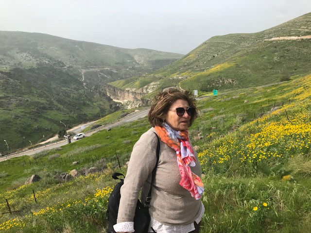
From a Hamsin heat wave, of the previous day's hiking, at Nahal Amud in upper Galilee the coolest unfriendly wind whipped against us at Ramat Hagolan's guided tour day.
(see post on the Nachal Amud hike from March/10/2021)
At Shaal

Sadly we departed early morning, from the coziness of the charming
Achuzat- Bar at Moshav Shaal, where we spent the night , but not before peeking into the pen, where the owners of the guesthouse - Liora and Arik - raise their sheep.

The owners invited us and our friends Idit and Shilo, to observe the birth of the new baby-lams, which were delivered throughout the night.
However the fatigue from the previous day's hike made us fall asleep early, while our friends restlessness, kept them wondering the few streets of the empty village in dark until midnight. Thus we all miss the action.
The final delivered products we saw in the morning were the cutest fragile creatures

The longer but most scenic, early morning drive from Moshav Shaal unfolded fantastic views, and carpets of flowers from the the North part of the Golan..

The longer scenic drive we took South onto route 978 to Left West onto Hwy 91 then Left -South to route 9088 until Kazrin intersection, then, Left toward East on Hwy 87 and Right -South into route 808 toward Aniam until Daliot intersection, Then Right -West to route 869 which leads down via Gamla Elevation connecting to Hwy 92 South, until Magan Intersection, and Right on Hwy 98 to Zemach.

6 couples of our friends who we invited to join us on the guided tour, already arrived at Zemach intersection's meeting point, at the south east tip, of the Sea of Galilee, when we showed up. right at 9:00am.

AYALA Tours
Usually AYALA runs adventurous tours abroad , but the diversion of the Corona era,
had their guides operate locally, to the great benefit of accidental visitors like us, who have been pretty much "stranded" in Israel for the past 10 months.
Gila - most dedicated, coordinator of AYALA's Israeli Tours' scheduling was most helpful in dealing with our growing sub group . 054 907- 7055 gila@ayalagroup.co.il
The guided group was lead by the fabulous Eshchar Jofee -Tour Guide
from AYALA Tour operation.
Eshchar is a very knowledgeable, enthusiastic and prolific guide, who runs his groups most efficiently, while minimizing group socialization and maximizing his guidance time.

Eshchar believes that touring audience should only stay in state of listenning.
Participators or contributors to the general knowledge, only detract or are redundant.
Furthermore he is a great champion of exercising physical relief in field conditions,
So don't expect to stop at public toilet facilities. They are not planned throughout the long day, in places like the Golan, where the vast empty nature welcomes fertilization....
First Stop -El Hamma Bridge - Vista Point (off Hwy 98)

A mighty wind gust almost blew off the group , of the bright green and yellow flowery cliff, where we stopped to spectate the spectacular vistas and the blown up famous bridge over the Yarmuk river, which is situated at the closed military area on the Israeli-Jordanian border.
The Yarmuk river runs in Jordan, Syria, and Israel. Its various sources rise in and drains much of the Hauran plateau. It flows generally westward and empties into the Jordan four miles south of the Sea of Galillee. Most of the water drained to the Kineret from these water sources are given to Jordan,
as per the the peace treaty from 1994.
The once intact celebrated Matthew Bridge used to cross the Yarmuk at its confluence with the Jordan river.

The bridge is part of a system of 8 tunnels (1,100m long) and 14 bridges and some 315 water crossing and aqueducts that facilitated the Jezreel valley railway, which passed on the bridge , climbing from Tzemach to Daraa (Syria): 73 km long with 529m height difference along the slopes of the Yarmouk river.
The Jezreel valley railway was the second railway built in Israel, after the Jaffa – Jerusalem railway (opened in 1892) and It was a branch of the narrow gauge 1,300 km Hejaz railway runnig from Damescus to Medina, a part of the Ottoman railway network also connecting it to Haifa to allow access to the big port,

Initiated in the 1900th by Sultan Abdul Hamid II during the many rebellions and decline period of the Ottoman Empire, it was named after the Hejaz region of Saudi Arabia. with German experteise and directed by engineer Heinrich Meissner. Construction was interrupted due to the outbreak of World War 1
The bridge have been blown up twice:
The first time (June 17th, 1916). by the Ottomans on their retreat or as a protest against Sykes–Picot Agreement, that disconnected the settlements of Galilee Panhandle from rest of Jewish settlements.
The second by the Para-military Hagana organization along with the Etzel and Lehi on Markolet operation "Night of Bridges" (16-17 of June 1946 ).
The target was to destroy 11 bridges that connected Israel to its surroundings Arab countries, and by that disconnect the country, as a protest on the British White Paper that restricted the Jewish immigration to Israel, Giving the Brits a taste of their own "medicine" it meant to prevent the them of crossing the borders, as they prevented movement to the Jewish people.
The rest of the 10 bridges which were blown up, that night were fixed and back to operation, this bridge is the only bridge left as it was.

This geological cracked scenery in this part of the Golan, consisting of dramatic canyons, faults and cleaves, was shaped by the Great Syrian -African Rift Valley movements, and is absolutely breathtaking, especially when so vividly green and flower carpeted in this season.
The Golan Heigts is referred to as both geographical and geo-political region in the Levant, spanning about 1,800 square kilometers.
This basalt plateau is bordered by the Yarmouk River in the south, the Sea of Galilee and Hula Valley in the west, the Anti-Lebanon with Mount Hermon in the north and Wadi Raqqad in the east.. It also refers to the area captured from Syria and occupied by Israel during the 1967 Six-Day War, territory which has been administered as part of Israel since 1981. Ancient Hammat Gader (hot city of Gadara)

The historical Helenistic/Roman town of Hammat Gader right in Yarmouk Valley was already a widely known health and recreation site, at classical antiquity, but sadly was gravely damaged by few earth-quakes,
Remnants of an amphitheater and mineral hot springs bath complex, with temperatures up to 50 °C. was built in the 3rd c, contained 2,000 seats and provided much pleasure to its inhabitants and many visitors of the past .
The site could be spotted from the vista point were we stopped.next to the Jordanian border,
al-Hamma before 1948 was a Palestinian village, only 12km Southeast of Tiberias
and as one of the stations linking (1905) Haifa to the Hijaz railway, it was a convenient stop for the hot springs recreation, at which many both Arabs and Jews alike frequented.

Zeev Sapir - a Russian born in 1900, an entrepreneur who immigrated to then Palestine was the founder of the Dagon Grain Silo in Haifa, as well as the co-founder with Suliman Nadif Baia, of the "Health Spa" hotel Marpeh n al Hamma.
The 45 room hotel ,an Arab-Jewish partnership, for which he paid in 1942 the legendary sum of 24,000 British pounds, (about 1.5 millions in today) was operating for 2 years only which after, it was evacuated in 1947, and despite an agreement with the Syrian to continue operating it, after 1948, a border feud of 1951, stopped the initiative.
Even after 1967 when he requested to re-operate it, he was denied, and was told by the Israeli land admin, that his rights to the land expired.

According to the armistice agreements of 1949 Between Israel and Syria, after the 1948 Arab–Israeli War, the area was included in the demilitarized zone (DMZ) between Israel and Syria, but invoked by villagers several skirmishes on the border, until Israeli control over Hammat Gader was secured during the Six-Day War in 1967,
Now a days Hamat Gader is Israel's largest and oldest spa complex containing farm complex and thermal baths. The water contains sulfur at a concentration of 4.7%, which is held as therapeutic effect on skin diseases, asthma, rheumatism and wrist pain.
Stop 2 - Ein Pik - Afik Hgolan (off Hwy 98)

The lengthy car caravan drove, up North on the gradual elevated Golan Plateau and landed us, at the left side of the road, by ruins of an Arabic village, at Ein Pik, built in a different era, in what was, before, also an ancient Bizantine village and next to what was once the biblical town Afeka - and later an ancient Jewish village from the second Temple period and until the 7th ad.
To the right of the road, a place called in Hebrew "Maizar" or land Isthmus, only 3 km from the Jordan /Syria/ Israel border, echo by its name its topographical passage importance, in between 2 water streams, flowing into the Yarmuk river.
Remnant of Pic include ruins which until 1967 was a Syrian village made of. Bazalt stone structures in Hauran architectural style.
During the six days war the Israeli air force bombarded the Syrian military strong hold concentrated in the village and thus opened all the south routes of the Golan plain..

Dense vegetation, in between orchards of almond, olive and pomegranate trees long ago, planted, are still irrigated by the near- by fresh water springs and pools.
Way below, an overlook of the sharp mountainous lava cliffs, a slice of the blue Kineret, the creek bed of Ein Gev stream ,with steps leading down from the view point, to its bottom, (which we didn't take ), and the archeological remains of 2nd BCE, of the biblical town Susita or Hippos as was called in Byzantine times, built on a hill, are all in sharp view. across.

One of most magnificent remains of a synagogue of the Byzantine period is the one in
Ein keshatot - Umm al Kantir - "Mother of the Arches"
The archaeological site of Ein Kshatot dates back to the mid-5th - 8th, and is one of the most important Jewish historic sites, situated near Natur village and adjoining the spring at Ein Keshat.
Excavations revealed pagan Roman-period settlement and later by Jews, who left behind the ruins of an exquisite synagogue. See video
The ancient Byzantine-era Synagogue in Um al Kantir (5th Ad) with its ornately carved basalt Torah ark, is one out of 30 built in the Golan, from the Mishna and Talmud era.
It was destroyed by the earthquake of 749.. It was first documented in 1884, by Laurence Oliphant and Gottlieb Schumacher. Last earthquake occurred in the area in 1921.
More on ancient Jewish settlement in the Golan
The spring flows all year round into three basins providing, early Jewish inhabitants in antiquity, refreshing water which were also used in the textile industry..
Water Pools, which, many of them are still being dug, and seen even now a days, maintains water well in the natural non-penetrable Basalt stone,were used for washing and whitening flax from which fine cloth were,woven.
The textiles were sold to wealthy residents in the nearby towns an abroad along with. mixed farming, raised grains sheep wine and olives,
The entire Golan flourished and benefited from its riches, until the 7th Ad when it emptied out. The Islamic invasion caused its Jewish and Byzantine inhabitants, to abdomen the area, and move away to the Mediterranean basin.. .
Battle of the Yarmuk of 636 between the army of the Byzantine Empire and the Muslim forces of the Rashidun Caliphate, which lasted 6 days near the Yarmuk river, resulted in complete Muslim victory and ended Byzantine rule in Syria.
In modern times, the Golan was reignited an turned into an industrial magnet with the construction of Trans Arabian Pipeline, during the British Mandate when an oil pipeline from Qaisumah in Saudi Arabia to Sidon in Lebanon via the Golan and should have been led into Haifa's port and the refineries was set in 1947.
The Tapeline which is a petroleum privately owned north–south asphalt road, begins near Mount Peres on the east edge of the central Golan, and ends in the northern Golan near the Israeli-occupied Golan-Lebanese frontier, is inaccessible to traffic, and gets its name from the now defunct oil pipeline of the Trans-Arabian Pipeline Company, which the road runs adjacent to.
In 1983 when the oil stop flowing in the pipe after the Siddon bombardment by IDF
the defunct oil pipe started carrying warm springs water for for agricultural irrigation. .

During that period also many very poor Farmers from the Hauran South of Syria moved into the Golan and further south as many working hands were needed in fueling the re-wakening.economy.
Stop 3 - Tel Saki - The "Irrigated Mound"
Driving further up north on the relatively empty Hwy 98 we veered to the right, where
the site of one of the most critical battles of the Yom Kippur War occurred.
Attacked by 11,000 Syrian infantry soldiers and 900 tanks, 60 paratroopers and 45 tanks IDF held off the Syrian army with determination and immense bravery for the days.
The surrounding around the volcanic mound is rich with ground water and once irrigation tunnels lead water to the fields, which still assure all year around very green lush vegetation.

Stop 4 - Giv’at Orcha Mound Juchader
This Bazalat nound further up North on Hwy 98 and only 1 km from the Syrian border holds ruins from the Mamluk period which had dominance in the region for the next 250 years, after driving off the Mongols who invade the region in 1259,
Ruins of Khan Juchader at Tel Juchader. reveals a story of an Inn, for both humans and their beasts. The name “Juchader” originates from a Mamluk honorific title for the “holder of the polo sticks”, presumably of the Sultan’s.

The khan -Inn was a resting, parking and ruling stop for the Postal Service coaches, on the Mamluk postal way, established by the fourth Mamluk Sultan, al-Zahir Baybars al-Bunduqdari (1260-1277) who also banish the Mongols
It operated in the Empire (1260-1516) and ran from the capital in Cairo to the capital of the north – Damascus and other important centers, along which every 40 km network of Inns- Khans and forts, were set. The Mamluk postal network was based on all 3 components: equestrian post, homing pigeons and fire/smoke signals.
Stop 5 -Butamia reserverour/ lake

A dirt road off 98 at the Orcha intersection, to the Right leads through Basalt landscape, green agricultural fields, and rows of vineyards, to one, out of the many,
man made water reserverour and pools, which captures loads of rain and flood water, during only the 3 month of winter on the Golan, in the same quantity as much as it rains in London, all year around. .
Eucalyptus grove surrounds the enchanting small lake, in which the locals like, secretly to fish their fresh fish. However us, who set near by, had for lunch the sandwiches we brought along, from home.

"Beware" posts were spread along these side dirt roads, warning against the many
mine-bombs which were left along the border within the Israeli fertile land side, from the wars and the contentious times with Syria,
Our guide safely maneuvered our car caravan through,and got us, safely back on the main pave Hwy.
The land has been coveted by private Israeli farmers who would pay a lot to clean them up, so they can buy and use the land, to plant vines for the wine industry.
Apparently the authorities are not that well cooperating.

Stop 6 - Ein Joaize - "Nut-Stream" Reches Bashnit

Ein Egoz was the water stream which served the Circassian inhabitants, who lived in Joaize village after many fled the Russian massacares and persecutaions of 1864 , leaving (1,5 m) their homeland (Adygea) in the Russian territory of the North of the Caucase, Upon the Ottoman invitation, many settled in several destination of the Empire including the Golan.
They were famed for their bravery, highly educated and known for protection, gaurding and agricultural activities.
The once 13 Circassian villages in the Israeli-occupied Golan Heights with a population of about 10,000, were abandoned and destroyed during or after the 1967 Six Day War and most fell into ruins. The displaced moved to Aleppo and Rukn al-Din in Damascus as well as Canada and other countries.

Under the large shaded Oak trees of a surprisingly enchanting dense forest at the foothiils of another dormant volcanic mount- Har Bental, by Ein Zivan village and next to Apple & Cerry groves (not yet in bloom) of Bustan Hagolan, our guide lead us to a hide out, where a holy Circassian cemetary held falling down carved tombstones, nesting peacefully, all these years, next to Mansure village. (1860 until 1967)

Now a days 50,000 reside on the Golan, of which 22,000 are Jews and 27,000 non Jews, There are 4 Druze villages - Majdal Shams being the largest of the 4 along with Ein Qiniyye, Mas'ade and Buq'ata . There is one Alaouite village,
And 35 Jewish, communities, with Katzrin town founded in 1977 and known as the "capital of the Golan".
Stop 7 -Vista Point -Tazpit Quneitra " Mitzpe Renen" (off 98)

And here in this vista point our friends were ready to pose for a group photo from above..
Fantastic views of the city of Quneitra in syria ( Rainbaw) which was largely destroyed and abandoned, UN Hub which coordinates the Israeli/Syrian border movements, the newly installed contravercial Wind Turbines which protrude on the beauty of the breath taking pastoral landscape, and which acts as slaughter blades to passing-by birds, as well as the snowy cap of Mt, Hermon, all can be seen, all the way far up to the East and North..

Passing Emek Habacha - "The Valey of Tears"
we paid our respect at the Oz 77 Monument , to the so many Israeli heroic soldiers who fought and sacrificed thier life at the wars on this front. (2020 HBO Film)
Special tribute should be given to fearless Captain Meir Zamir from "Tiger" Tank force, who managed to destroy many enemy tanks, and other vehicles that rolled down the Golan, toward Israeli strategic points, but without having Israeli casualties.
Stop 8 - Ram Pool - High Pool - Birkat el-Ram

Further up North on Hwy 98, and soon after passing the Druze village - Mas'ada of 3,700 mostly Syrian inhabitants, when turning to the Right - where a sign post says OP73 - the road takes you into an unpaved narrow path, which curves steeply down hill, in-between lovely orchards.
Suddenly, the amazing view of crater lake Ram Pool, comes into full view, from the top of the hilly landscape.
Also the large Druze town (12,000) of Majdal Shams , "tower of sun," and of birth-rate...
in the southern foothills of Mt. Hermon. can be fully glanced at, on its stone houses rolling off the steep slops across, .
Rain water and an underground spring fill the lake that was formed inside the crater of an extinct volcano and which has no outlet.

2 Legends
The Talmud, Sanhedrin 108a, tell a legend that Brekhat Ram is one of three underground springs, along with Hamat Gader in the southeastern Golan Heights and Hamat Tiberias, that opened up in the Flood of Noah and didn't close up again after the flood.
In a local Druze legend the lake is the "eye" of the "sheikh's wife", the name for a hill nearby. Mount Hermon (in Arabic Jabal al-Shaykh, "Mountain of the Sheikh"), referred to as the sheikh himself, is supposed to have been separated from the "wife", whereupon her eye filled with tears

And at this final beautiful point, where our guided tour came to an end, for another reason also, my eyes were filled with tears, due to the coldest wind, which blew us off, the narrow path, at the end of this long, but most interesting and enjoyable day, spent with most seasoned guide, and a great bunch of dear friends.
A Bonus Stop - Self Guided visit at " Saar Falls"

Scenic route 989 on the the way down from the Northern Golan, meets Hwy 99 below Nimrod Fortress, at the easily accessible vista point, of the picturesque and full of gushing Saar River water fall , or in its Arabic name Wadi Hashaba ,
Its rain and melted snow water flow from upper Golan and Mt Hermon in the North, into the Banias in the South-West.
Since our good friends , stopped, spontaneously, at the Vista Point, our entire sub-group of car caravan, did likewise.
And, just shortly before darkness engulfed and hid the mesmerizing views, and prior
to us continuing with the drive for the group's dinner in Magdalena, we manged to have final "sniff "and a true "feast " to the eyes, of the invigorating falls.

Dinner at:
This long day really ended up, when we relieved our hunger, (as well as our other basic needs in a real toilette..) with most tasty and enjoyable "Final Supper" by a long table set for 12, at the great Arabic restaurant - Magdalena (By the Kineret off Hwy 90).
The excruciating painful long drive, back to Tel-Aviv, was definitely worth this entire wonderful, interesting, joyful exploration day with dearest friends,
THE END


Comments