Travel: From Adana via Cilicia Gates to Cappadocia, Turkey, Oct 19/2022
- Oct 19, 2022
- 7 min read
The Course of the trip

On the way departing Adana province, the bus passed by the Snake Castle/Fort

Yılankale -Seljuke Snake Castle/Fort
Located on a rocky hill overlooking the east bank of the Ceyhan River,
the castle is locally known as the home of Shahmaran, a mythical creature half woman and half snake
It is a late 12th[7]–13th c castle also
known in Armenian as Levonkla[ "Levon's fortress") after its possible founder—King Leo (Levon) I the Magnificent[(. 1198–1219) of the Armenian Kingdom of Cilicia
Driving via the Taurus Mountains


Driving through the lower Cilician passage gates then the narrow upper gates, indicated a change in elevation, color and in weather.
The the green pine tree landscape transformed along the way into the vast yellow plain, much cooler and drizzly.


Cilicia famous Gate Passage

Hwy E 90 along the Syrian African fault, follows an ancient road from the Black Sea via the heart of Anatolia, through the Taurus mountains, all the way to the Mediterranean Sea, and along which many of the vassal states to Rome existed.

Tabula Putinger map - a 13th-c parchment copy of a possible Roman original. an illustrated itinerarium (ancient Roman road map) showing the layout of the cursus publicus, the paved travel road network of the Roman Empire.
The Cilician Gates, the only pass through the Taurus Mountains between the plains of Cilicia and the Anatolian Plateau, featured regularly in numerous military campaigns.
Contributions to World Culture innovations in theology and disciplines and in Agriculture, were facilitated by this passage, and those who traveled through and had control over it.
The narrow pass in the Taurus Mountains which is the most important corridor of communication between Cilicia, the Mediterranean coast and Anatolian Plateau.

The Battle of the Cilician Gates in 39 BC was a decisive victory for the Roman general Publius Ventidius Bassus over the Parthian army and its Roman allies who served under Quintus Labienus in Asia Minor.
Cilicia is the ancient Roman name for the southeastern region of Asia Minor -modern-day Turkey. The territory was first inhabited in the Neolithic Period c. 8th millennium BCE.
It was under Hittite control by the 2nd millennium BCE before passing to the Assyrians,
then taken by the Persians before the conquest of Alexander the Great in 333 BCE.
The region became Hellenized, divided between the Ptolemaic and Seleucid empires,
overtaken by Cilician Piartes when the Seleucid empire weaken (110BC) until in 78-74 BC when Rome intervened, and conquered western Cilicia.
Byzantine Empire until the early 8th century CE when it was taken by invading Muslim forces. The Armenian Kingdom of Cilicia flourished in the region between 1080-1375 CE before it fell to the Mamluks and was later incorporated into the Ottoman Empire in 1453 CE. Because of its geography and location, Cilicia was among the most important regions of the classical world.
Kemerhisar- Tyana - the Arch Fort
Tyana was the name of an Hellenistic then Roman Ancient City in the southern part of famous Cappadocia. region, in modern Kemerhisar, village. deriving its the name from Tuwana which was briefly capital of a Luwian-speaking Neo-Hittite kingdom in the 1st millennium BC. -the vassal of Roman Empire.
The Amazing Aqueduct

Despite its favorable location, the town is rarely visited by tourists, yet it is worth it.
Ruins from Roman times and especially remains of a beautiful and amazingly preserved 1.5 km Aqueduct, (2nd AD) from when the town was an important settlement during in the Roman Empire era, can be seen in full view, in the midst of town center, and along the main road. we walked om, for over an hour, in this, now a depleted insignificant sleepy Kemerhisar village


In the center, the aqueduct is the highest. and it gets lower and lower, from zero to 6m in altitude, going east, towards the fields surrounding Kemerhisar, to finally disappear into the ground.
The aqueduct - a symbol of the town - which had been constructed by the emperors Trajan and Hadrian. brought drinking water to ancient Tyana from a spring, (see below) now known as Köşk Pınar, located in Bahçeli, 4 km to the east from Kemerhisar.


Situated on a fertile plain this agricultural community is surrounded by apple gardens and vineyards around the town, growing also onions and potatos
Scenes of Kemerhisar village


After the town was incorporated into the Seljuk Empire in the 11th century, the Turks called the city Kilisehisar . The name was later replaced by the name Kemerhisar referring to the historical Roman aqueduct within the town

A contemporary of Christ, and the most famous dignity of the town the Greec apollonius was born in Tyana In the first C AD (1-97)
The neo-Pythagorean philosopher and orator whose his activities influenced the intelligentsia. and earned him a reputation as a miracle-worker, and healer of the sick. also claimed to be the Son of God,
He is the subject of Life of Apollonius of Tyana, written by the sophist Philostratus (170 –247) over a century after his death. Apollonius' biography was often likened to the life of Jesus Christ. and his divine reputation, persisted long after his death.
Philostratus implies on one occasion that Apollonius had extra-sensory perception.
The spread of his new religion and miracles. were reported in his life, while those very similar assigned to Jesus, were disseminated about 100 years after Christ's death
Julia Domna - a Roman empress (160 to 211 AD) born in Roman Syria (Homes) to originally Arab Libyan family, was the wife of Emperor Severus and the mother of Karkala and Gette, who lived in Antioch.and who requested and funded the written biography of Apollonius by Philostratus.
Domna is thought to have died before Philostratus could finish his work of eight volumes.]
As an Empress, (193 to 211) Domna was famous for her political, social, and philosophical influence. Unlike most imperial wives, Domna remarkably accompanied her husband on his military campaigns and stayed in camp with the army
She also influenced Roman fashion: the hairstyle that she used, seemingly having made the wearing of wigs, a custom of Assyrians, popular.
The Beautiful Roman Water Pool - Spring Source for the Aqueduct
(End of 2nd-begining of 3rd AD)

The water storing reservoir -water pool built in Roman time meant to store water from still active natural spring water flows, and transporting it, depending on topography, by underground water pipes or with aqueducts. Water canals are still buried from the pool to the inner part of Kemerhisar .
The spring, now known as Köşk Pınar, located in Bahçeli, Village - 4 km to the east from Kemerhisar. was enclosed In Roman times, with a rectangular pool, which has now been restored (1967)


The chief surviving monument fine stone aqueduct, with its many arches brought water from Köşk Pinar, a strong spring below a small Neolithic settlement, where the rectangular spring-head basin was excavated and restored as a swimming pool.
At the excavation from where the canal meets the starting point, coins where found from Emperor Caracalla (198-211)
Continuing to Nidge
The planned lunch at the quint picnic area by the pool, had to be changed due to the non-promising cloudy weather. So as to stay dry but not hungry, instead we sampled
lunch at a place in town .
As with other Turkish towns of the the South, brand new high rise developments, welcomed our entry to town.


Lunch at:

Sofram restaurant - Nidgje
Was beautiful and very good

The Capital of the same name province, located in south central turkey, at an elevation of 1,250 m, below a hill crowned by a ruined 11th-century Seljuq fortress, near a number of ancient trade routes, between Kayseri and the Cilician Gates, north-northwest of Adana.

It is relatively small town of 150k inhabitants, generally very religious and conservative. The town is surrounded by plenty of green space and gardens around the houses. and lives off flour milling and wine making and the manufacture of cement, textiles, and tools.
Sultanate of Rum -precursor of the Ottoman Empire

By the early 13th c Niğde was one of the largest cities in Anatolia.
A prosperous and important city of the Seljuq sultanate of Rūm, Niğde by 1333 was, nevertheless, in ruins, probably because of the wars between the Mongols and Karaman, a Turkmen principality that succeeded the sultanate of Rūm.
Niğde has many medieval (Seljuq as well as Ottoman) buildings,
Medieval monuments are scattered about the center of the town, especially around the market place.


We visited only the Alâeddin Mosque (13th c);, but there are also Sunğur Bey Mosque (14th c), built by the Mongol chief; and Diş Mosque (16th c). The octagonal Hudavend Mausoleum dates from 1312. The Ak Madrasah (1409), a former religious school, now houses the regional museum of antiquities.


The domed mosque made of cut stone, which is situated in the historical Castle/Fort of Niğde, was constructed on the Alaaddin Hill, in 1223 just before the Mongolian invasion, and during the period of Great Seljukian Monarch Sultan Alaaddin Keykubat -one of the most successful sultans of the Seljuk Empire- (1220–1237) commissioned by the Niğde Governor Zeynettin Beşare.
The mosque reflects the entire delicacy of the Seljukian adornment art and is especially the first and the interesting samples in the architectural scope.
The chief architect of the mosque was Sıddık, the son of Mahmut. His brother Gazi was his assistant

The neighborhood next to the mosque on the hill, which has been under constructions looks like it a war zone or hit by earthquake, full of destroyed buildings lots of debris and rubbish, a most unappealing sight


Approaching Cappadocia
A historical region in Central Anatolia, where we spent the next 4 days.

The Cappadocia region is made of an enchanting colorful landscape in white, pink and grey Tuffa volcanic ash colors and of erosive Rock formations, in which Cave Churches Cave Monasteries, and Cave Dwellings, in the thousands, most from Byzantine time and artistically decorated, can be observed, on both sides of the road, we traveled on.


Cappadocia with its transformational cultures intertwined with the forces of nature as reflected in the magnificent valleys, and underground cities, provided refuge, protection
and an amazing body of art.
A Visit at:


The Byzantine-era cave monastery, in the small town of Gümüşler, 10km northeast of Niğde town is carved in a large stretch of rock , the spaces arranged around a square courtyard measuring 13×60. These spaces consist of the kitchen, corridors, rooms and the church. it is thought to have been built between the 8th and 12th c.
There are many monasteries carved into the rock in Cappadocia.consisting a church and includes dinning halls and courtyards, but this one, is of the best preserved and largest of its kind in the Cappadocia region,
Rediscovered in 1962,and restored, it was declared a protected archaeological site in 1973,


The church comprises four freestanding closed aisles based on the Greek cross plan. The northern aisle contains a niche with two tombs. To the west there are two entrances covered with a cradle vault. Three different masters are assumed to have worked on the church frescoes.
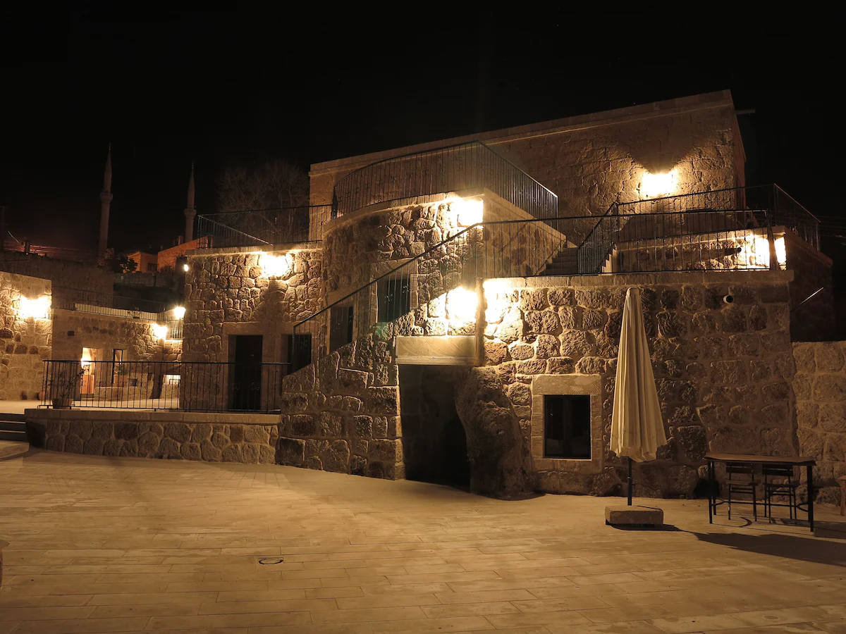
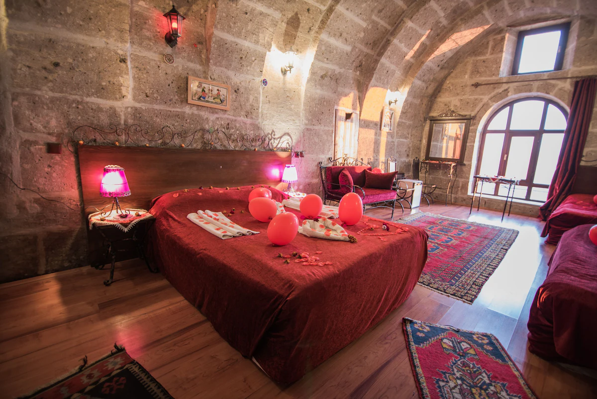
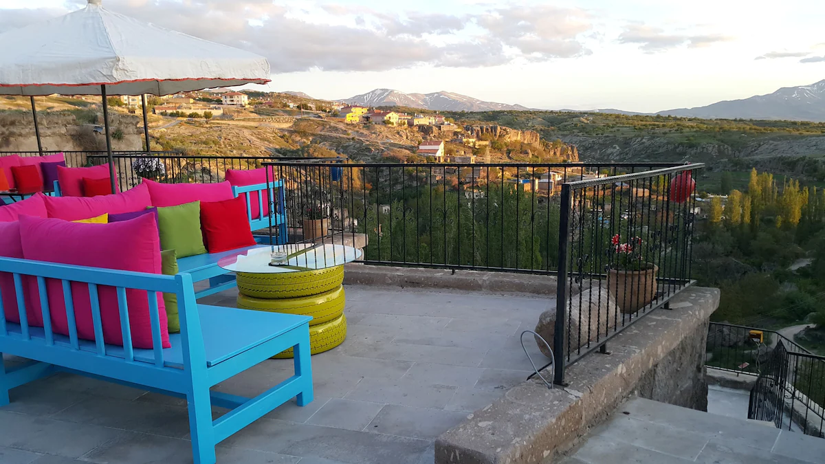
Being the last item visited during this long day, retreating for the night into a Cave Hotel was in the spirit of this region we came to explore
Guzelyurt Village - Capaadocia- where we stayed.


Dinner and one night were spent at: Ihlara Mansions & Caves
Gelveri /Guzelyurt Village - Capaadocia
Charming decent place overlooking a gorgeous setting.

To be continued....


Comments