Travel:Antarctic Peninsula. Polar Plunge. Oct 29-31/2025
- Nov 1, 2025
- 11 min read
Updated: Dec 24, 2025
A continuation of a trip to Antarctica and other parts of Chile which includes posts from Oct 22nd -Nov 23rd


Most cruises, like ours to the 7th continent, after successfully crossing
the Drake's Passage mainly tour the Antarctic Peninsula, which is the northernmost, most accessible, and "warmest" part of mainland Antarctica,
The Peninsula stretches toward South America, and is the closest to it and relatively calmer and safer to navigate,

This mountainous, ice-covered extension is characterized by mildest Antarctic climates, diverse marine life dependent on krill, and significant ice shelves,
It is renowned for its rich wildlife (penguins, seals, whales), stunning icy landscapes, numerous research stations, and popularity as a tourist destination
When the Silver Wind anchored at the northern tip of the Peninsula, the weather during these next 2 days consisted of foggy overcast grey skies, a brisk breeze,
with temperature below zero C
.and off and on snowy drizzle

The Places visited on the Trip

Antarctica - mainly a Polar Desert
The main-land continent of Antarctica, is Earth's southernmost, the fifth-largest continent, being about 40% larger than Europe, and known for its turbulent passageways, gusty winds, below zero temperature striking, iceberg-flanked and isolated Terran.
The uninhabited, ice-covered landmass. is a site of the South Pole virtually, and a polar shelter to rich wildlife, Most of Antarctica is covered by the Antarctic ice sheet, with an average thickness of 2 km. On average, it is the coldest, driest, and windiest of the continents, and has the highest average elevation

About 70% of the world's freshwater reserves are frozen in Antarctica, which, if melted, would raise global sea levels by almost 60 m
Antarctica is governed by about 30 countries, all of which are parties of the 1959 Antarctic Treaty System.
+++++++++++++
This intended 10 days Polar Voyage, included 2 daily exterior excursions - morning and afternoon- weather permitted, via zodiac (or canoeing) each lasting max 75 minutes
Morning Exploration of Spert Iland
Anchorage at Spert Il. at the Northern tip pf Antarctica's Peninsula

Stepping onto the island is forbidden, thus the zodiac tour was only by water.

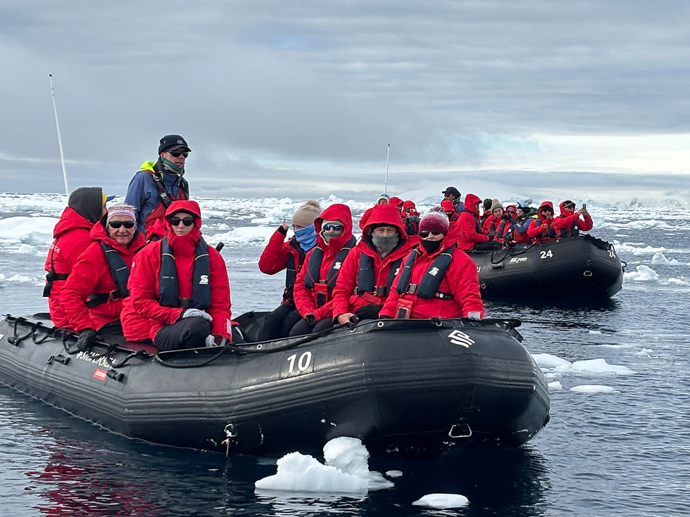
Heavily bundled up with several very warm layers, and also protected from the freezing drizzly rain or powdered snow by Silver Sea Expedition's Red parka a group of 8 of us, were huddled into the slippery zodiac. I hardly kept my balance when stepping down into the boat, in which we kept getting, slowly but surely, frozen, during the this polar boat tour.
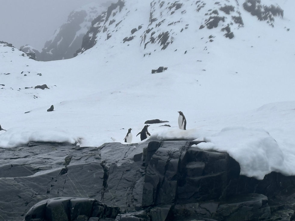
Sailing around the rocky island and avoiding the floating icebergs and icicles at sea, revealed roaming Chinstrap and Gentoo penguin, some playful seals, swimming in the frozen water as well as few birds species on the lookout above the rock-tops.
Spert Il on the Arctic Peninsula


The island is located at the northernmost part of mainland Antarctica., in the Palmer Archipelago, also known as O'Higgins Land in Chile and Tierra de San Martin in Argentina, and originally as Graham Land in the UK and the Palmer Peninsula in the US.
Spert Island was named by the United Kingdom Antarctic Place-Names Committee (UK-APC) in 1960 for
Sir Thomas Spert, Controller of the King's Ships in the time of Henry VIII, founder and first Master of the Mariners of England.


Spert Il is made up of extrusive volcanic rock, predominantly basalt and andesite. formed from lava flows during the Jurassic Period (around 199-145 million years ago) as part of the Trinity Peninsula Volcanic Group.
These dark, rugged volcanic rocks form dramatic cliffs, making the island geologically distinct and a popular, though challenging, landing spot

Glacial processes have carved out numerous narrow canyon-like straits through the archipelago, and at least two sea arches/tunnels. Some imposing rock formations and deep water close to the islands, allows for massive icebergs to drift in and become stranded.


In the afternoon another on board Zodiac exploration

A small bay in the Palmer Archipelago, which provides excellent anchorage for ships, and was frequently used by sealing vessels in the first half of the 19 C and by Norwegian whaling vessels at the beginning of the 20C


Mikkelsen Harbour was discovered by the Swedish Antarctic Expedition (SAE) of 1901–1904. The origin of the name comes from Peder Michelsen, a whaling manager who was lost in the whaling grounds in 1910.
The original plan was to make a landing on one of the 3 outlets of the island and then hike on shore. However all 3 landing points were ice clogged, and made landing impossible. so the polar scenery was enjoyed off the zodiac circling.


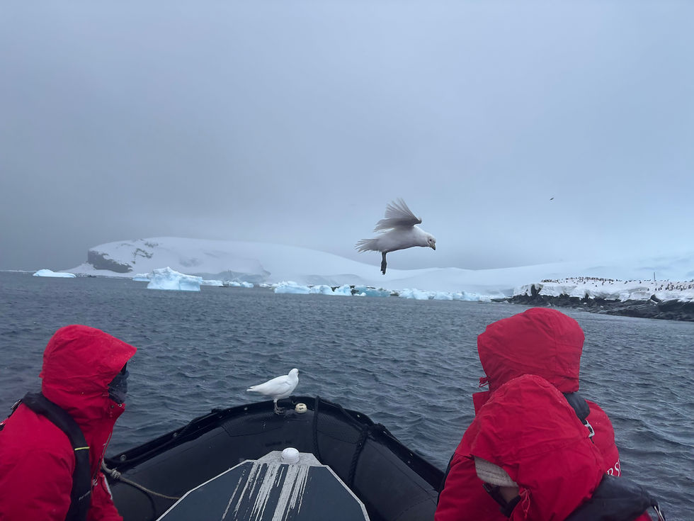
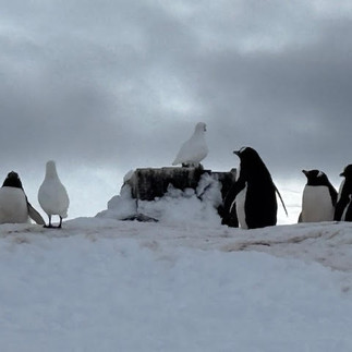
The zodiac excursion among floating white bluish icebergs in the image of shape-less sphinxes, when nearing the snowy reddish poop covered island' shore, revealed a Red refuge protective cabin surrounded by a colony of penguins,
Hovering white birds, hoping for incidental feeding from the invaders to their territory, followed the sail from the sky above, with some fearless ones, also joining the ride with us, on the zodiac
The overcast grey sluggish freezing weather with a wind at 25 km/hour, made the afternoon outing to the small island an absolute sheer torture


The following day, upon waking up, the Silver Wind moored, as so far, in the most peaceful bay named Charlotte Bay, surrounded by floating, enchanting icebergs and icicles , all around

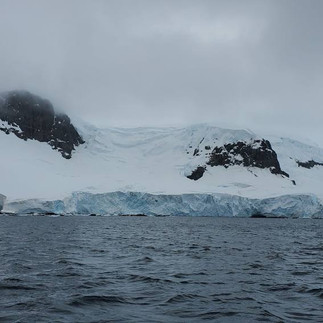
Situated on the west coast of the Antarctic Peninsula it is known for
its stunning, dramatic scenery with towering glaciers (like Nobile & Renard) feeding into the bay, abundant humpback whales and seals, unique ice formations (bergy bits, growlers), and its role as a prime spot for expedition cruises,
The bay was discovered by Adrien de Gerlache during the 1897–99 Belgian Antarctic Expedition and named after Charlotte Dumeiz, the fiancée of Georges Lecointe, Gerlache's executive officer, hydrographer and second-in-command of the expedition.
A fresh drizzle of soft snow powdered the floating ice, the chilling sea water
and the frosty voyagers, when sailing the zodiacs, early morning, in a calm
wind-less weather ,with subzero temperature, toward Portal Point.


Portal Point - Continental Landing
The narrow point consisting of Mesozoic granite, on the bay covered with snow and ice, from which a route to the Antarctic land plateau was established. It was so named by the United Kingdom Antarctic Place-Names Committee (UK-APC) in 1960 because it is the gateway of that route..
A British recluse refuge which was established there in 1956 was dismantled in 1996 and transported to the Falkland Islands Museum and National Trust, where it was rebuilt inside the new museum in 2014.

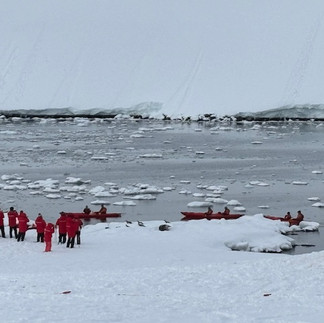
Staff Scout are dispatched prior to each group zodiac landing, and only after safe landing is determined, the expert Expedition Team sets up Red marking flags on the ice /snow ground, to follow indicating the permitted walkway, with Penguins' paths having first right of the way..

There can be hidden crevices/cracks under the snow, so it is a real risk not walking exactly on the the marked trails, bordered by the red flagged poles. that the Expedition Teams set , only after ruling out danger zone, and declaring safety.


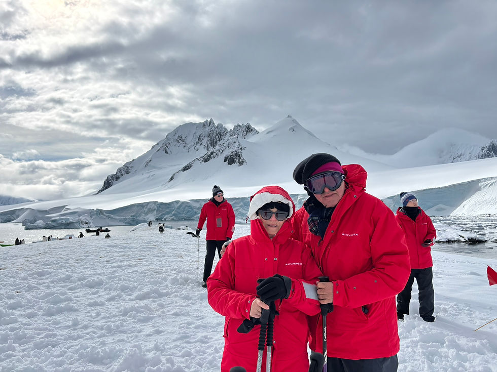
After scouting the Portal's landing area, early morning, the crew carved steps in the ice at the zodiac landing's point, and,marked by the red flags , a safe passage way, up the snow covered hill so we could loop-walk steady, and enjoy the magical scenery of Charlotte Bay and the imposing drifting icebergs off the point's hilltop,


Portal point often has Weddell seals hauled out near the landing. or on the ice flows, as well as different sea birds, which we encountered as well.
There are no penguin colonies because of the abundant snow cover.


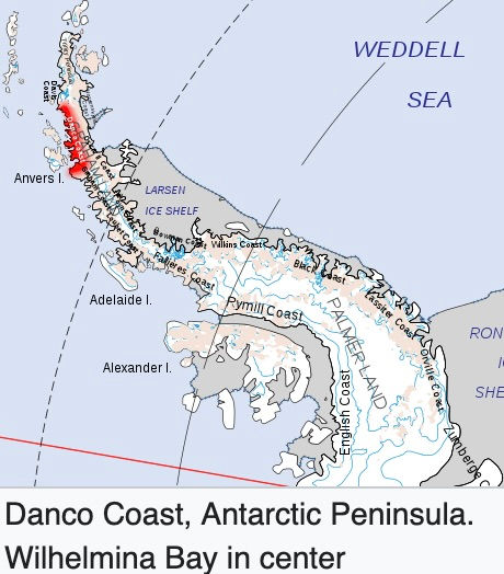
The weather unexpectedly brighten up in the afternoon when the Silver Sea reached yet another siren glacial Wilhelmina Bay, also surrounded by ice covered mountains and peppered by amazing shapes of drifting broken ice floats which leisurely swung in the relatively calm chilling sea water.
The scouters confirmed that landing was safe . so the Expedition Team went to set up the safety marking poles. A warning of crevices deep as 50 feet. and more was given as not to sway away but to hike exactly near the flagged poles
The sheltered bay’s water are surrounded by stunning glacier scenery
sheer ice cliffs and glacial sculpturing ,
The Bay is on the Danco Coast on the west side of the Antarctic Peninsula
in between Charlotte Bay to the northeast and Andvord Bay to the southwest
It was discovered by the Belgian Antarctic Expedition of 1897–99
led by Adrien de Gerlache. but named for Wilhelmina, Queen of the Netherlands,(reigned from 1890 to 1948).
No landmarks on the whole west side of the Antarctic Peninsula have been named after the Belgian Royal Family, in fact, since they did not support de Gerlache’s expedition. but the Dutch Royal Family did, thus the bay was named after the Dutch queen.
The reveals

The Bay is an incredible "Whale-Mania" hotspot, teeming with humpback whales
which are known for their acrobatic breaches, distinctive fluke patterns, and cooperative "bubble-net feeding," making them a highlight for Antarctic wildlife watchers as they recover from past whaling,
A study undertaken in 2009 found a super-aggregation of krill - a key species in the Antarctic ecosystem and in terms of biomass, in Wilhelmina Bay, with a large number of humpback whales feeding on them.

Antarctic Chad Gadia
The Algae that grows at sea that feeds the Krill that feeds all Antarctic Wilde Life


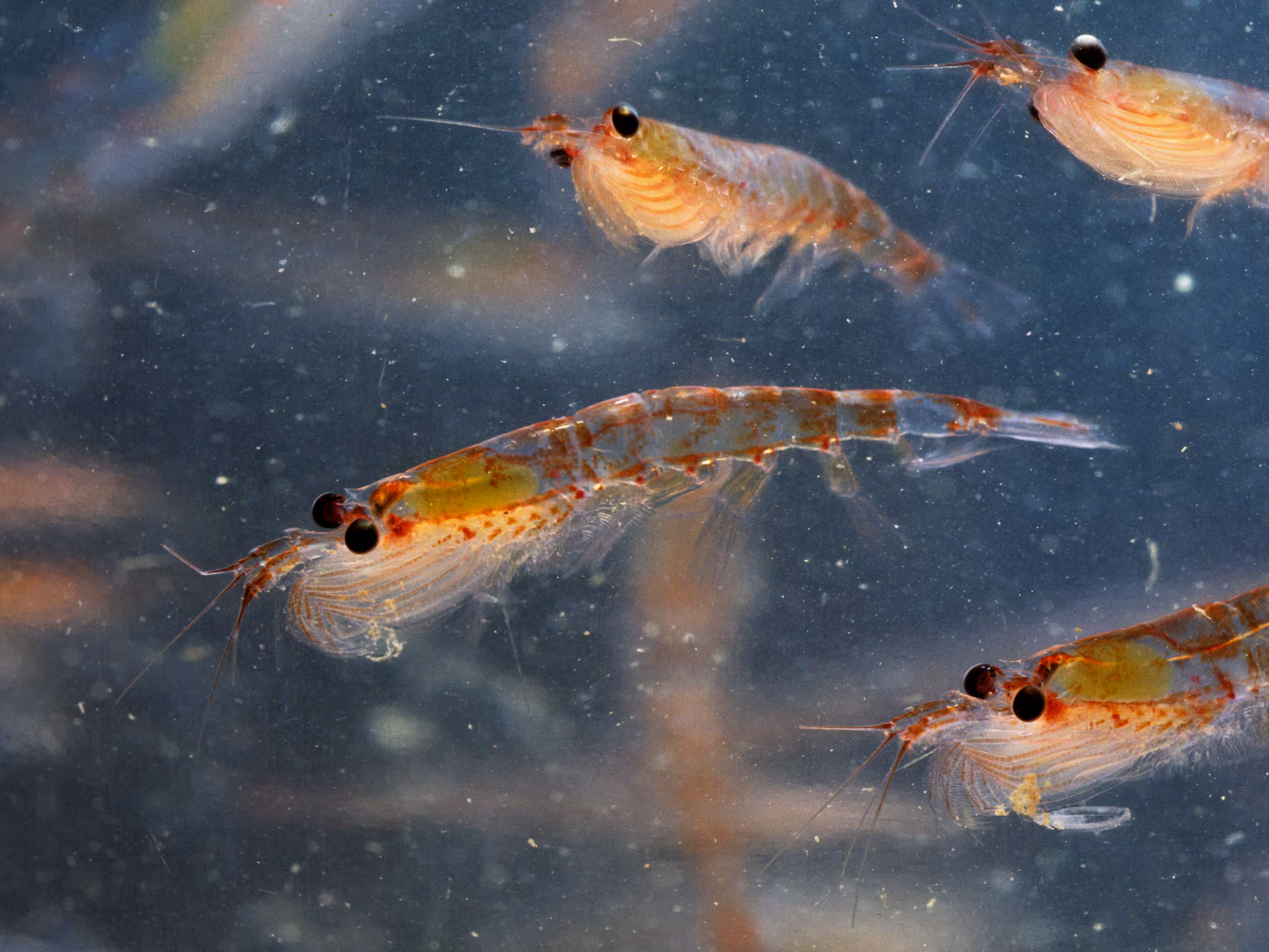
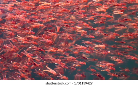
The small krill (6 cm/wight 2 grams) a swimming crustacean lives in large schools, called swarms, sometimes reaching densities of 10,000–30,000 animals per cubic meter
and lives up to 6 years. It feeds directly on minute phytoplankton,
Krill and the whales are abundant in late autumn along the western Antarctic Peninsula, particularly in Wilhelmina Bay, where the whales eat as much as possible in preparation for the winter, building up fat reserves for their long migrations to warmer breeding grounds near the equator.
As we visited in early spring, a very small representative delegation of nature wildlife was encountered during our short Zodiac cruising,

Waddle seals on a ice float and a hump Back Whale, were seen in the distance


Waddle Seals are the southernmost breeding mammal on the planet. famous for their unique, slow, humping movement on ice and their incredible adaptations for living year-round in the extreme Antarctic, including creating breathing holes with their teeth and deep, long dives for food. They are the southernmost mammals, known for their placid nature, distinctive calls, and significant role in Antarctic ecology
"Arctic Plunge" a Popular Polar Mania on Cruises

Polar plunge - diving off the ancored cruise ship into the calm ice cold sea water of the Bay got a clearance from the ship's captain just prior to Thanks Giving
To my relief I managed to restrain David
who opportunities for recklessness really excites him, from executing this madness

Out of 197 passengers of all ages, 140 actually signed
for this insane plunge to the icy water from a special designate zone, which needed first to be cleared out off any floating icicles

Men with only bathing suits and women with just bikinis, or nothing at all were ready to line up. We know it because the captain asked the youngsters (25-40) to wear at least something ..
The cheering audience was watching
this mania entertainment from the safety of the ship's freezing decks.


As the wind picked up and the swell increased after maybe 70 heroic plungers, the craziness, was paused, to be resumed in a more agreeable weather conditions.

Friday the 10/ 31
The calm icy water in the peninsula channel surrounded by tall sharp peak mountains all decorated by white snowy dense powder, promised a cool uneventful outing.


However the ship's scouts informed that the continental landing at the day's first destination - Brown Station -wasn't safe due to big ice blockage.

Brown Station is an Argentine Antarctic base and scientific research station established in 1951 near Paradise Harbor on the Sanavirón Antarctic Peninsula, and is named after Admiral William Brown, the father of the Argentine Navy.
.The station served as a permanent base from its construction until 1984, but now it is only used during the summer for the purposes of scientific research.
So the station was was viewd only from the zodiac


Sailing through Neumayer Channel to Damoy Point
The weather further brighten up in the afternoon, and at times even the sun piped up .The tranquil sea water at the channel was covered by floating ice, and still no other ship was seen on the glacial horizon, as if we were the only ship left sailing in the world.

is 25 km long narrow water way, in Palmer Archipelago, .no more in many parts, than 2.5 km wide .
The long glacier-fringed waterway is shaped like an S . It is also often blocked by pack ice, especially now early in the cruising season. It is more than 200 meters deep enabling larger ships like the Silver sea to sail through it.
The towering cliff walls on the channels' both sides were cover with a virgin whitest snow, when we sail through.


Damoy Point Hut on Wienke Il
Damoy Point is a headland on the northern entrance point to the harbour of Port Lockroy, in the Neumayer channel on the western side of Wiencke Island in the Palmer Archipelago.
It was discovered and named by the French Antarctic Expedition, 1903–05, under Jean-Baptiste Charco.


After proper prior scouting and carving in the fresh fallen snow a safe landing for the zodiac, the voyagers managed to climb up on the provisional snow steps
created, and onto the observation point on the snowy hill's top of Wienke Il


Below a perfect ice pool, surrounded by towering snowy mountains, served a great habitat for the penguin's colony, seals and birds.


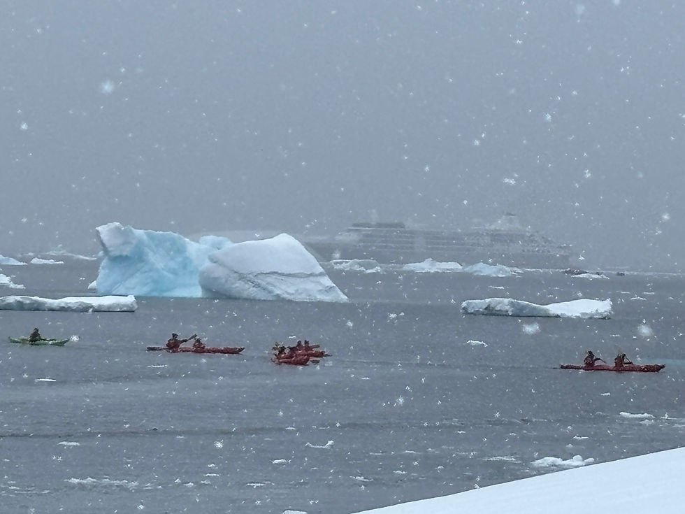
Those brave Kayaking at this surreal challenging environment, had an incredible time

On Wienke Island

A well-preserved hut containing scientific equipment and other artifacts stands at the point. Built in 1973 and used for several years as a British summer air facility and transit station for scientific personnel. It was last occupied in 1993. Since 2009, the hut has been managed by the UK Antarctic Heritage Trust, a British charity responsible for managing six historic huts on the Antarctic Peninsula


The hut is open to visitors, so after roaming through it, I jokingly remarked that `my plans to reserve it, for next summer vacation. got nixed as it has been"fully booked"...


The surreal Habitat of the Antarctic


Elephant seals, fur seals, Weddell seals and leopard seals as well as many species of sea birds can be encountered.


Avian Flu Influenza
The Antarctic was free of Bird Flu influenza however this world epidemic has unfortunately reached on its spread to the south also these remote parts of the world. recently,

Highly pathogenic
bird flu (HPAI H5N1) has reached Antarctica and the sub-Antarctic islands,
It has been spreading rapidly since its first detection there in late 2023, causing significant mortality in seabirds, impacting penguins, and raising major concerns for the continent's unique wildlife, posing a threat to remaining isolated populations


Lemaire Channel -"Kodak Gap"

Named for Charles Lemaire (1863-1925), a Belgian explorer of the Congo., the straight which is 11 km long and just 600 m wide at its narrowest point. is nicknamed "Kodak Gap" and is one of the top tourist destinations in Antarctica, due to its spectacular scenic of towering steep cliffs hem in the iceberg- filled passage, and its protected waters which are usually as still as a lake, a rare occurrence in the storm-wracked southern seas.
The channel was first seen by the German expedition of 1873-74, but not traversed until 1898, when the Belgica of the Belgian Antarctic Expedition passed through it.


Since our sail was early in the season the ship encountered the principal difficulty of proceeding through the channel, due to too much ice which clogged the channel, and which obliged the ship to backtrack.
That last night of the month (Oct 31st) dinner decorations on the ship were very spirited
Happy Halloween

To be continued....


Comments