Travel: San Pedro, Atacama Desert , Chile. Nov, 17-22/2025
- Nov 23, 2025
- 15 min read
Updated: Jan 11
A continuation of a trip to Antarctica and other parts of Chile, that started on Oct. 23
The driver who piked us up from the Calama's hotel to transfer us to the San Pedro's hotel resort , arrived an hour later then expected, when actually, filling in, for another driver who hasn't shown up, We arrived at San Pedro at late lunch hour. with a welcoming bottle of wine awaiting in the room, to compensate for the lateness... and
to intoxicate the annoyance from memory...


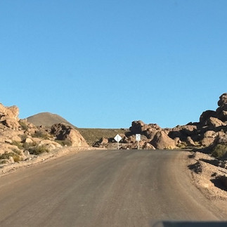
The desert's plateau scenery of the hour and 15 minutes drive from Calama to Sam Pedro on the narrow 2 straight lanes road, is mostly monotonous arid.

The landscape is boring until just a bit prior to reaching the Oasis of San Pedro, when the landscape reveals majestically dramatic Salt Plains formations, salt pens and a clear marked verdant tree-line, separating the yellow/grey barren volcanic land from the life within the oasis's borders.
Cordillera de la Sal,

Salar de Atacama.


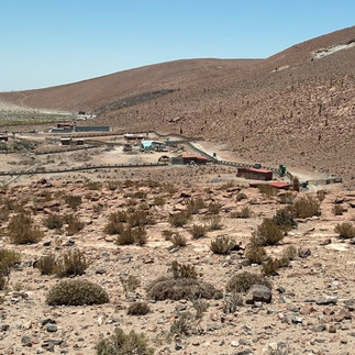
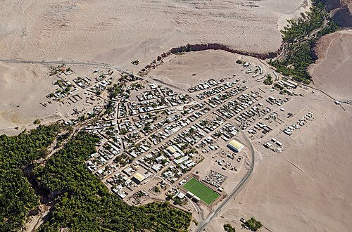
The small oasis town set on an arid high plateau in the Andes mountains, is located some 106 km southeast of Calama at 6,600 fts above sea level. overlooking the Licancabur volcano, The name means ‘village hill’, and it was venerated by the Incas, who carried out ceremonies and left offerings in the crater of its top.

The main economic activity of Its population of about 2.500 inhabitants, is based in tourism and agriculture.thanks to the San Pedro de Atacama River which flows through the region. It is formed by the confluence of the Rio Grande and Salado rivers and provides water for the local communities and agriculture.
chañar capsicums. carob


The water facilitates an exuberating vegetation,formed by chañar trees,
carob trees, and capsicums.
and hotel services Hotels from 2 to 5 stars, as well as restaurants and pubs,
The town is the center of the Indian culture of Atacama, whom lived the desert a long time ago


The village is famous for its attractive dramatic surrounding. Its landscape incorporates some of the highest summits of the Andes Mountains, desert, and Los Flamencos National Reserve, presents salt flats, volcanoes, geysers, high dunes and hot springs. Famous are Valle de la Luna (Valley of the Moon), surrounded by pink-streaked mountains and desert wind shaped rock formations
Valle De La Luna

San Pedro also known as "The archaeological capital of Chile" full of history..It is the birthplace of the civilization of Atacama, which established its settlement in the highland regions and desert cliffs. since 11,000 years b.c., The oldest human remains found there. The Tulor village, which is 3,000 years old, is one of the best examples of the historical and archeological richness of the place. The desert sand covers most of the ruins, and only a 4% of the constructions have been dug up, so we can only speculate about what is hidden under the sand.. .
Ancestral cultures and travelers from all over the world mingle in this ancient village with dirt streets and adobe houses, where handicraft shops, institute the main entertainment on Carocoles (Snails) main Street


The upscale Atacama Lodge is an upscale refuge amidst the rugged landscapes of the Atacama Desert. It offers 50 rooms of award-winning architecture, within its pristine 42 acres desert oasis lush estate. encompassing natural verdant large courtyards, where horses roam around, as well as multiple pools, a spa, and world-class Observatory for watching dazzling Atacama night skies. A wide range of desert fantastic exploration activities, including, tracking, bathing in nature spas stumbling on dunes, biking and horse riding excursions are all offered.


Matheo - the assigned Explora guide, planned with us the exploration activities, once we checked in, for the next 5 days . He who is originally from the Patagonia's Puerto Arenas, switched his extreme windy cold town, of the south, for the utmost hot aridity of the northern desert.
Daily activity schedule


The Explora lodge is far from the opulent East African Lodges on water holes or river banks. ,However we loved it's oasis version and have met interesting people like Suzanne and Hart from Chicago, Lisa from NJ, Frederica and Rodrigo from Santiago, Lara from San Paulo, Merry and Jonathan from Sidney and Paul and Armen from Uruguay/Paris
(now Israel) with whom we shared excursions and who all made our stay so very enjoyable.


The room's accommodation is large and most convenient, public areas are lavish and inviting, service and food are great and most excursions' guides are friendly but at various inconsistent knowledge caliber..


The view from our window of grazing horses in the attached yard


The Explora was highly recommended by few of our acquaintances, and is indeed best value for what it promised to be deliver.ed. We too highly recommend the place and thoroughly enjoyed our 5 nights stay here. though 4 nights but not less, are sufficient.
Still staying 5 nights or more would guarantee taking advantage of all the exploration possibilities and activities being offered, including the special traditional BBQ dinner night, at a designated safe location on the lodge's premises, spiced by cultural flair of local musicians and dancers
David especially enjoyed the taste of the local BBQ lam ribs.
It was interesting to find that 60% of the Explora's guests are from Brazil - craving the desert experience they lack in their tropical country, and the other 40% from other Latin countries, Europe, UK and Australia/New Zealand mainly


The hotel will be wise to also keep handy, a list of private doctors and medical clinics in Calama offering services to tourists in need, as non are provided in San Pedro.
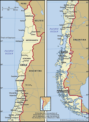
San Pedro Atacama Areal Map

.
The Excursions/Activities we enjoyed
Arrival afternoon - Nov 17 - Salt Mountain Range
A guided exploration combination of an half an hour drive and short walking to point of interests located Just before the entrance to the town of San Pedro

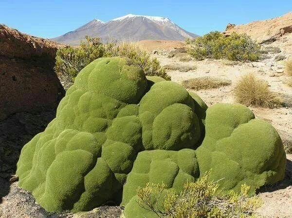
Cordillera de la Sal, is a range of hills and mountains composed of a large amount of calcium sulfate, formed over millions of years part of the Andes.
23 million years ago by the uplift of an old lake-bed as well as shaped by wind, rain, and sun. a distinct dramatic topographical formations were formed liken to the Moon Valle formations,
The amazing attraction.to localas and tourists includes: fantastic rocks outcrop a great variety of natural sculptures, which the calcium sulfate,gives them the aspect of being splashed with salt. different types of stratification and varied coloration by the mineral diversity of the place.
It is distinctively different from the Salar de Atacama, which is the vast salt flat in the region, and have been visited and mentioned later


Chemical Rock fusion. Man made deserted bus Erosion sculptured Rock


Morning. Nov 18 - Puritama Hot Springs

Half an hour ride on the way to the geothermal springs, the small (3 couples) guided group got off the car to take an hour hike over a rugged landscape terrain, along the lush green vegetation of the Puritama River route
While hiking some wild life and an archeological site, were encountered
It is one of most popular and enjoyable excursion


A deserted small Inca's native stone-made doweling know as Tambo and a stone pen-structure where Llama herd was kept fenced were situated just about the river course


Encounter with Llamas
Llama is a domesticated South American camelid
The two wild South American camelids, which live in the high alpine areas of the Andes;
are Vicunias and Guanacos. Vicuñas are relatives of the llama, and are now believed to be the wild ancestor of domesticated alpacas,
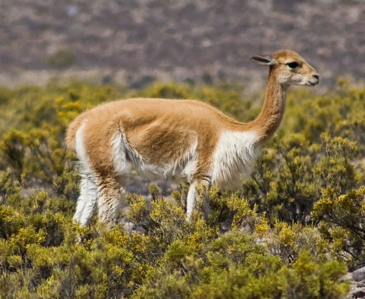
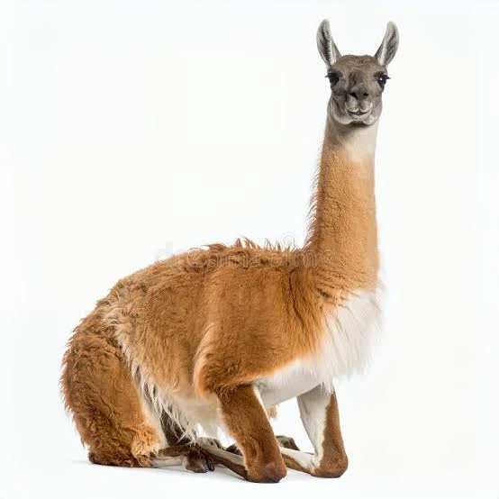


Lives High Altitued. lives at lower elevations
Lama Andean Pinch


Vegetation Growth Between 2,600 and 3,800m height


tall and robust cactus Aromatic endemic desert shrub


Termas de Puritama Hot Springs
The Springs area series of 8 large geothermal spring water pools is located 28 km and away from San Pedro, at the bottom of a canyon at an altitude of 3,475 m, and have a temperature between 28 ° and 31 ° c
The springs stretch over a length of about 1 kim of the Puritama River, which has cut a winding valley


The mineral thermal water comes from the Sairecabur volcano and has many medicinal properties. Its water has a significant concentration of minerals, including calcium, magnesium, sodium and boron, all revitalizing elements for the body and mind
The sodium sulfate waters are recommended for rheumatism, arthritis, stress, physical fatigue and other ailments.
The hot springs are managed since 2011, by the Explora hotel, which charges a fee to get in, but not from Explora hotel guests who are exclusively privy to pool number one and are spared of the crowds in the other 7 pools


Explora private spring pool # 1

Explora built changing room and bathroom facilities next to the pool area, where towels and refreshments weere oferred, and time to sip/sweem is given.


Afternoon= Nov 18 -Valle de Marte -Mars Valley


This striking valley is located in the middle of the Cordillera de la Sal - the Salt Mountain range, only 2 km, 20 minutes driving distance from San, and is close to the Moon Valley, .
The landscape is similar to the Valle de la Luna, but still much less crowded.


It is a mountainous and sandy valley, characterized by strange geomorphic and topographic formations, jagged rocks, rocky sculptures, towering sand dune, and dramatic viewpoints of the distant cordillera.
The stunning landscape is also named Valle de la Muerte -Death Valley as it represents not only its red rock features, but also due to the fact that in the past, whoever dared to cross this valley died in the attempt. Proof of this are the remains of animal bones or people that can be found in the place, as well as pieces of natural plaster that many times are confused with these vestiges.


The 2 hours guided hike which proceeded along the deep canyon ridge, then down the steep sandy dune was quite challenging, at our advance age, much older then the others in the group in their 30th However we kept up heroically with this young crowd and treasured the exploration experience.
Just the strong wind made it hard to keep at balance. So with the help of carrying rocks in my hands to "beef my wight against the wind tried to fend against the blow.
David admitted, after successfully making it down, that the dune was higher and longer than any dune he crossed in the Sahara


After being "cleansed" at he geothermal Spa we got "polished" on the Dune


Dune we descended in a wind of 60k /hr
When alerted by the trip planner, to the challenge of the dune,, David decided that since he had crossed the Sahara- 15 years ago , a dune of Atakama would be a "piece of cake:"
It was not easy for us but we did it!


Morning - No 19th - Hierbas Buena ancient petroglyphs and Rain Bow Valley

Located in the Antofagasta Region ,northwest of San Pedro and an hour drive from the hotel, the guided group first stop was at a giant rock of the Domeyko Mountain Range,
The rock is known as the archaeological site of Hierbas Buenas . into which distinct ancient petroglyphs were carved and drown by those who stopped there. The rock is positioned very near by to the Rio Grande River and served in the past for several centuries, as a resetting place for herders, traders, and travelers, a commercial meeting point for the passing caravans providing water and shelter
The caravans crossed the Andes on their journeys from the Northeast of Argentina and the Bolivian Altiplano to the Pacific Ocean


The preserved pre-Hispanic rock carvings and drawings were etched in stone, thousands of years ago by Indigenous peoples, who once inhabited the valley.


One of the petroglyphs portrays
2 Camelids connected with 2 heads, when it is clear that in nature such a position like with the 2 Vikunias can be seen

Varied anthropomorphic figures, animal figures, hunting scenes, and sacred symbols all are seen, including llamas or Camelids, birds, and dogs, drawings of flamingos, predatory animals, and even a monkey. surrounded by a stunning natural setting.

There are small llamas, big llamas, pregnant llamas and herds of llamas .
Local guides will spice up the interpretation with stories of mystical, tall tales.
There are also numerous vestiges of corrals and shelters built by shepherds and caravanserai during their stays here.
Second Stop - Rain Bow Valley

At 3,500 m above sea level and not too far from San Pedro de Atacama, (90 km) lies the Arcoiris Valley ("Rainbow Valley"). located in the basin of the Grande River, and very close to the Petroglyphs of Hierbas Buenas.
The dramatic and colorful scenery is stunning, and also attracts many wildlife
On the way climbing up in altitude


The Rainbow Valley owes its name to the great variety of tonalities layers observed in the hills of the valley; earth colors, reddish, beige, strong shades of green, white, yellow, combined with the white salts,, all against the blue sky,
Millions of years of erosion have since carved the valley into its current shape. of strange formations and great colors show of different clay, salts, and minerals.mix
The dry ravine is in the Cordillera Domeyko mountain range

At the bottom are layers of iron-rich red ochre clay deposited by the eruption of the volcanoes that formed the Chilean Coast Range.


On top are layers of rock salt, gypsum, and calcite deposited by the Salar de Atacama


between are rises of rocks formed from cooled magma that contain iron and magnesium that bonded with other elements and became green through oxidation


Other minerals like cobalt and lamprophyre give the valley other unusual colors like yellow, blue, pink, and purple

Lack of valuable minerals such as lithium and copper common elsewhere in the region, Rainbow Valley has remained untouched by mining, remaining in its pristine, eroded state


On the way Back along the Rio Grande River


Afternoon Nov 191th - Flamingos in the Chaxa lagoon

On the way to the shallow, high altitude, body of water part of the Los Flamencos National Reserve, 65km from San Pedro , in the middle of the Salar de Atacama. at 2300 m height


In the midst of the jagged landscape surrounded by volcanoes, mountains and ranges, this rough salt flats' crust and shallow crystal-clear water, lagoon is an oasis of activity which provides an indescribable peace to its plankton and shellfish-rich waters.


Chaxa Lagoon was created by the evaporation of subterranean water in the Salar de Atacama, a large salt flat. Over time, this process led to the accumulation of salt, which formed the lagoon's crusts and provided a unique saline environment where its specialized flora and fauna, including flamingos, adapted and thrived
In comparison to lake Nakuru Africa, there weren't many Flamingos at the a Chaxa


The lagoon which is divided into several lakes is an accessible flamingo-breeding site. where diverse communities of flamingos inhabit within the. salt crusts which are especially abundant, and in which 3 of the 5 known species can be spotted, as well as plovers, coots and ducks


Morning -Nov 20th - El Tatio Geysers Excursion
We lucked out having Franco as our guide -one of the best of Explora's guides- on the excursion to the El Tatio Geysers, which is situated at an amazing Volcano's caldera, about 1.5 hours drive away from San Pedro.

Climbing the mountainous elevation


Encountering flamingos early morning,
at a well-known stop on the way to the volcanic geysers site, by the enchanting Machuca's wetlands, was a wonderful start of this bright shiny desert cool day.
The magical place is a shallow tranquil and nutritious habitat to the 3 species of flamingos, other desert birds, and roaming vikunas

Machuca Wetlands
The enchanting elongated known for its high-altitude wetlands area at about 4,000m above sea level. is
near the small Andean village of Machuca .


Scenery of the wetlands at the high altitude


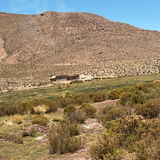
The village itself is tiny, made of only 20 houses and a church accommodated in the past the sulfa mining workers..
Today the population is of only a few people, and its main activity are the llamas, though, currently the few inhabitants of Machuca are beginning to participate in tourism, already having a hostel and offering some crafts.


The scenery up to the volcanic area


At the Andes Mountains
Major volcano noticeably stand out in this part of the desert's landscape are
Part of the Andean volcanic arc . it is astratovolcanoes - composite volcano ,which is typically conical volcano built up by many alternating layers (strata) of hardened lava and tephra . It stands at 5,884 m above sea level, straddling the border with Bolivia. and is known for its vigorous fumarolic activity. last erupted in 1810

El Tatio lies at the western foot of a series of stratovolcanoes which runs along the border between Chile and Bolivia. This series of volcanoes is part of the Central Volcanic Zone (one of several volcanic belts in the Andes), and of the Altiplano–Puna volcanic complex (APVC) – a system of large calderas and associated ignimbrites


El Tatio is the highest volcanic geothermal field in the world, at 4,320 m above se level, with many geysers, where water and steam columns spring up violently from deep under the ground.
It is the third-largest geyser field in the world and the largest in the Southern Hemisphere
This spectacular geothermal field has many geysers, hot springs, and associated sinter deposits.
Tatio Geysers reach their peak of activity between 5:30 am and 7:30 am, when water columns reach up to 10 meters, thus the early morning visits to the site , which requires warm closing at the coolest morning hours. brings up a long caravan of visitors to the area.
The geothermal vents are sites of population of: extremophile microorganisms such as hyperthermophiles, and El Tatio has been studied as an analogue for the early Earth and possible past life on Mars.

The site is surrounded by an astonishing volcanic scenery of arid desert and most known peaks like Licancabur, Sairecabur, Toco, and Láscar.


Full day Excursion - Nov 21st Volcano Monicase surroundings
The proximity to these 2 small traditional villages on the way to Atacama Salt Flat, passes through them and often the tours stop in them for lunch or other bodily functions


Toconao - A Place of Stone
Located 38 km from San Pedro at an elevation of 2,485 m above sea level, this traditional small oasis village , which its houses are made of volcanic brick stone, dates back more than 12 thousand years ago
Congregation of nuns from the order Jesus Verbo y Víctima. maintains the notable church and bell tower of San Lucas, originally from 1750.


Socaire - village of the Chilean highlands.
the tours that go to Piedras Rojas and the Altiplánicas Lagoons (Miscanti and Miñiques) stop for lunch in this place
Located in at 3500 m above sea level, 86 South from San Pedro, last Chilean town 400 people living on route CH-23 towards Argentina, through the Sico Pass.
some terraces of crops and plantations of fruit trees, quinoa, alfalfa and corn
church of Socaire, that is historical patrimony. It is built with adobe walls
The village owes its importance not so much to its being the main viewpoint of the salt flat, but also to its craftsmanship. The traditional weaving of sheep's wool and camelids

The massive volcanic complex, which consists of four overlapping volcanoes formed by lava domes and stratovolcanoes a large number of craters, and flows,
t has two summits, a lower northern summit which reaches 5,790 melevation and a higher southern one which is 5,910 m
Its visited attraction are the high plain lagoons of Laguna Miscanti, Laguna Miñiques and the Cerro Miscanti volcano
Salars are salt flats that have formed after a long process by which salt accumulates from salt lakes. and as the lake dries up, it becomes a large salt flat.

Large Salt Lagoon - Red Rock Salt area
the high-altitude salt flat in an altitude of about 3,950 is part of a series of salt flats located in a volcanic crater and surrounded by reddish rocks formation
known also as Laguna Salar Talar,
its vibrant colors, in contrast to the white salt deposits of polygonal shapes and proximity to other geological formations.
makes the place magical


Located at an altitude of more than 4100 m above sea level, and about 2 hours from San Pedro,, these 2 stunning deep turquoise-blue lakes, which are close to each other are separated by a lava flow off the Miniques Volcano. They lie majestically among the towering volcanoes of the Andes. surrounded by golden grass and snow-covered peaks,
,


The glacier evolved lakes are part of the National Reserve Park which is known for its dramatic volcanic landscape and is home to vicuñas, foxes, Andean birds, and flamingos..


Tropic of Capricorn
On the way back we stop by the sign
posted at the Atacama desert to mark the 23 Degree latitude on the glob's southern hemisphere and can't be missed when driving on the "never ending" straight desert road .
Last Day -Nov 22 , Horse Riding
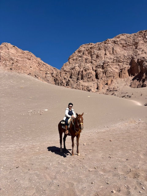
On our last day at Explora Atacama, prior to heading back to Calama to catch a flight back to Santiago, we were signed for a short horse riding excursion to the near-by dunes,
I ended up riding solo with
Tamara, an excellent guide, whose refreshment course and clear instructions ,reminded me the basic rules of handling a horse, which last I did ,over 25 years ago , when we resided in the Netherlands.
That was a risky though very pleasant
grand finale endeavor of my desert stay.


Ricardo the Driver
David 's failed efforts to book an UBER transfer ride, from the Explora hotel in San Pedro to the airport in Calama, was due to a misleading app. However it yielded a chance encounter with Ricardo.
Apparently there is no UBER service in San Pedro , despite the popping up app.
When searching for, a driver, in the middle of the town's center, we incidentally run into a by-passing car, and casualty inquired the driver if he is a "Taxi" willing to give us a ride to the Calama airport. on the following day
By sheer chance Ricardo agreed, and picked us up on Saturday after my horse riding,
Ricardo, a true fantastic Chilean, residing in San Pedro Atacama, who worked there as a waiter in the past, and now is a free soul enjoying exploring the dessert, took the best care of us. So here is his info:
ricardopizarrotorres@gmail.com +56948478000
Departing Atacama Desert


Getting back to Central Valley


Landing in Santiago

THE END !
.


Comments